One of our most anticipated day trips this year had been the
trip planned several months ago to visit Chornobyl, the site of the world’s
worst nuclear disaster that happened a little over thirty years ago. There were
no preparations we had to contend with going to one of the world’s most
contaminated sights apart from ensuring we wore pants and closed-toed shoes and
socks. We each only have one pair of river shoes with us for this entire four
month trip, apart from shower shoes in hostels, etc, so we could only hope that
they would suffice. We were told that the amount of radiation we would receive
while on the tour today would be less than that while on an overseas flight.
When we got to the meeting spot before 8, we noticed that a
number of other people going on the tour also had jackets or wore long sleeves
but we had not been notified to bring or wear either. I wished later we had -
you’ll see in the photos later why I say this.
There was such a large group going that there were four
shuttle vans but luckily each one was basically its own tour complete with a
separate tour guide. At no point did we
feel, therefore, we were part of a mass of humanity going from place to place
for the next 11 plus hours.


It was about a 90 minute drive to Chornobyl so, to bide the
time en route and find out about what had happened 30 years ago, our guide put
a video on for us all to watch. You may notice that the facts and figures I
reported in the previous post from our visit to the Chornobyl
Museum
So, according to the video, a series of detonations went off
in Reactor 4 at 1:23 am on April 26th,1986 at the nuclear power plant located
3 kms from the town of Pripyat which had 45,000 inhabitants. It was staggering
to discover that a second explosion was only just averted that would have been
ten times worse and have resulted in half of Europe
being wiped out. The morning of the explosion, i.e. eight plus hours post explosion, life in Pripyat went on normally
for the inhabitants and children continued to play in the town’s parks. There were rumors that something was amiss but nobody was
told anything even though there were masked soldiers in the streets. The Geiger counter readings
that afternoon were 15 times higher than normal and, by evening, they were 200
times normal.
Workers in other parts of the plant wondered whether the machines
were working normally. Twenty hours after the explosion, the levels were still
rising but the population in Pripyat had still not been informed about the
disaster. No one was told to stay inside or to take iodine pills. The orders to
evacuate Pripyat only came 30 hours after the detonations. But, to avoid panic,
the residents were not told of the seriousness of the situation. In only 3.5
hours, the town of 42,000 (according to the video but 55,000 according to the Museum) residents were evacuated peacefully according
to the video. The only people that stayed behind.were scientists and military
personnel.
Sixty hours post explosion, there had been NO official word
from the Soviet Union to other countries announcing what
had transpired with Reactor 4 at the power plant near Pripyat. Yesterday, at the
National Chornobyl Museum in Kyiv, we had learned that nuclear power plant
workers in Sweden were found to have high levels of radioactivity and that had
been the first international sign of the disaster. Three days
after the explosion, US
spy planes took photos of the damaged reactor. The temps at 200 meters above
the reactor ranged between 120-180 degrees Celsius. The planes couldn’t get
any closer because of the smoke.
All of Europe was at the mercy of the
winds those first few days. The initial signs of radiation poisoning were
vomiting and diarrhea and then there was a latency period before deterioration
of the bone marrow and life threatening burns. For a full 15 years after the
explosion, the Soviet Union only recognized the first
victims of the catastrophe. There was only one tiny report on page three of
Pravda, the official newspaper of the Soviet Union
reporting what had happened near Chornobyl.
The Soviet authorities refused to acknowledge the seriousness of the explosion. They even encouraged May Day festivities to take place in Kyiv located just 60 miles away fromthe blast site. To this day, only one private cameraman’s footage of those festivities in Kyiv remains as all official photos are mysteriously missing from the National Archives.
The Soviet authorities refused to acknowledge the seriousness of the explosion. They even encouraged May Day festivities to take place in Kyiv located just 60 miles away fromthe blast site. To this day, only one private cameraman’s footage of those festivities in Kyiv remains as all official photos are mysteriously missing from the National Archives.
Ten days post explosion, USSR President Gorbachev asked the Chief of
the UN Atomic Agency to be the first Westerner to visit the site.
Six hundred pilots flew in sand and then lead to seal the white hot magnesium under the reactor. Many of those pilots died from making as many as 33 flights each day over the reactor. The aim was to cool down the burning reactor as quickly as possible. Workers toiled in 50 degree Celsius temperatures for just minutes at a time wearing NO protective gear to build a tunnel to divert the fires. Workers were told they received between 30 and 60 Sieverts, (the measurement of radiation levels) but medical records later unearthed indicated they had actually received 5 times that dose.
Six hundred pilots flew in sand and then lead to seal the white hot magnesium under the reactor. Many of those pilots died from making as many as 33 flights each day over the reactor. The aim was to cool down the burning reactor as quickly as possible. Workers toiled in 50 degree Celsius temperatures for just minutes at a time wearing NO protective gear to build a tunnel to divert the fires. Workers were told they received between 30 and 60 Sieverts, (the measurement of radiation levels) but medical records later unearthed indicated they had actually received 5 times that dose.
One hundred thousand troops arrived initially from every republic in
the Soviet Union to assist in the cleanup. All animals
had to be killed so they couldn’t contaminate the liquidators, the term coined for the men involved in the cleanup process. Each night, the
machines, trucks and men were covered in radioactive waste after a day’s work.
Eight weeks after the explosion, workers needed to begin building
a sarcophagus or stone coffin, to totally enclose Reactor #4 which had
exploded. The men could only work for seconds to a minute at a time because of
the radioactive waste. Finally, only remote controlled machines could be put in
but that could only be done by workers. The robots gave out because of the heavy doses of radiation so the men
had to enter while covered in lead protective gear, each weighing 26-30 kilos.
The men performing these onerous tasks were called bio-robots, They had to
shovel the radioactive debris off the roof of the reactor and push it off into
a ditch below. They could work a maximum of 45 seconds at a time, i.e. enough
for only a couple of shovelfuls. What would normally take 10 men to do in one
hour took 60 men to accomplish. The sarcophagus would only last for 30 years,
i.e. until this year,
Just as the Soviets had earlier changed the numbers with the
amount of radiation workers had received, there again was the tendency to
manipulate the facts: people were miraculously healed and released from the
hospital.
It was interesting to learn that twenty years after ‘Chornobyl,’ only the French government still refused to
admit that the radioactive cloud had passed over France
and Corsica. This was despite the fact, though, there have been many reports of
thyroid issues associated with high radioactivity doses in France .
There are both 10 km and 30 km exclusion zones around the
plant and we arrived at the 30 km zone at 10:15
almost two hours after leaving Kyiv. The map below shows the two contamination zones.
There are approximately 26,000 square kilometers in the exclusion zones but no arable lands in that area. Fishing and hunting are allowed for
food only. Scientists are always monitoring how animals in the zone breed.


There are some ‘self-settlers’ living in the 30 km exclusion zone; they are residents who chose to return after being evacuated
from one of the abandoned villages. Our guide said most of the settlers choose
to live in or near the current Chornobyl because they can receive services and buy
groceries, etc.
The shrine dedicated to the liquidators:


Dasha mentioned that twenty five per cent of the town of Chornobyl
is now used for offices and scientific purposes. No children are allowed in
Chornobyl because they are particularly susceptible to any radiation poisoning.
There is a curfew after 10 pm and alcohol is only served and available for two
hours a day. The power plant was named after Chornobyl, an 800 year old town,
and not for Priypat which was a ‘company’ town.
Current workers at the plant are only permitted to work for
four days at a stretch and must leave the zone on their off days. Likewise,
firefighters, shopkeepers, etc cannot stay in the exclusion zone when not working.
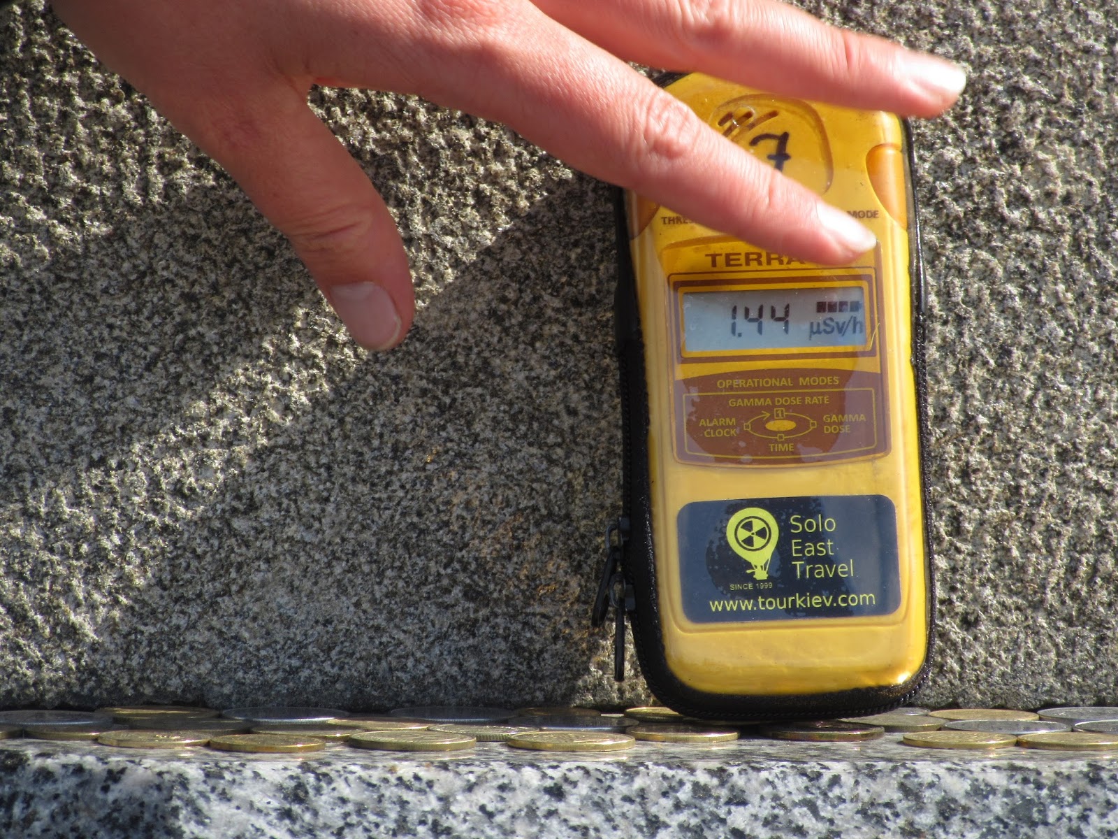
The radiation levels at the checkpoints are less than in
Kyiv, our guide told us. About 18,000 visitors a year enter the exclusion
zones. Scientists say animals who produce an antioxidant can survive in
radioactive zones but humans don’t produce the antioxidants.
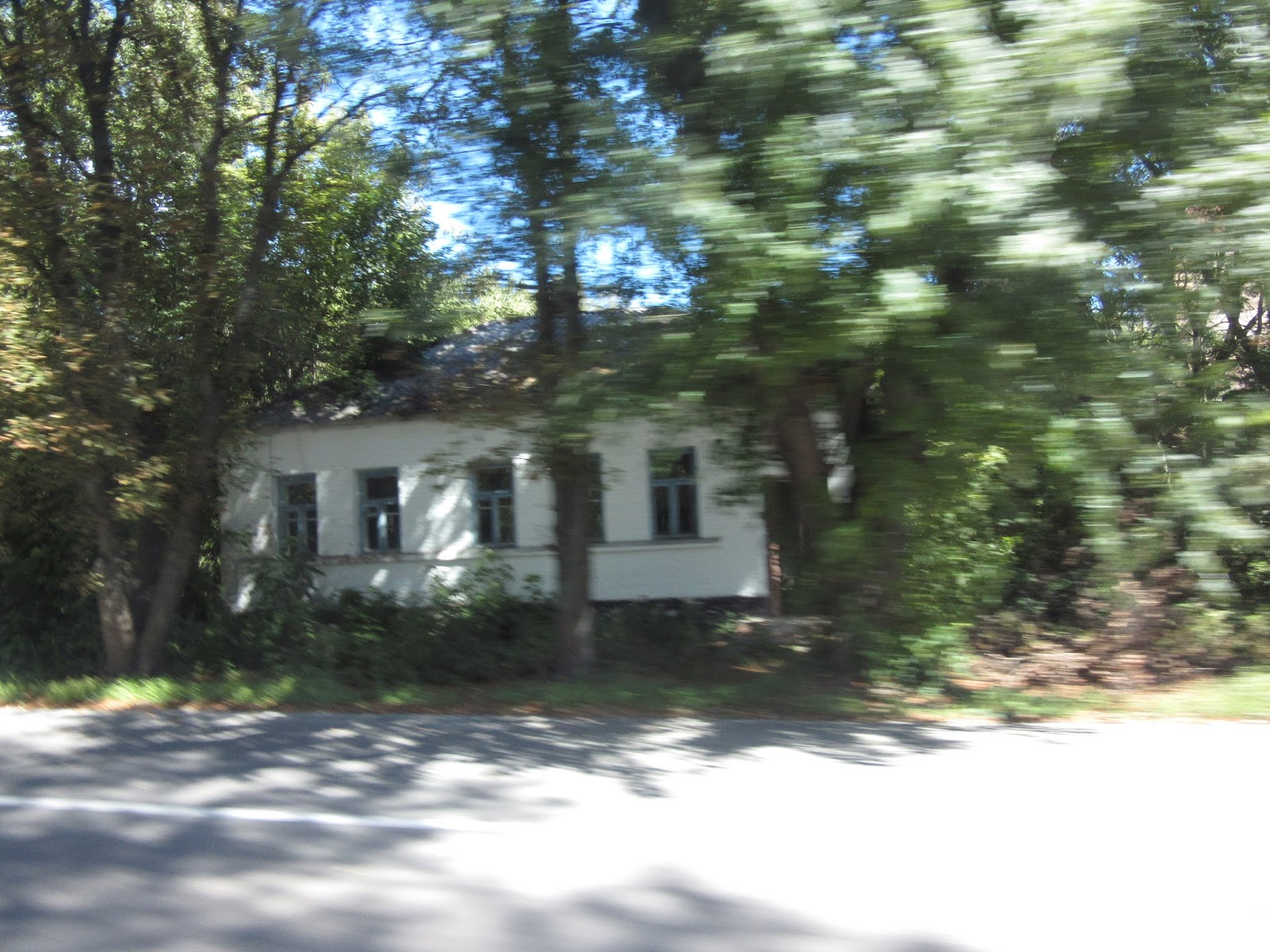
It was great when the driver stopped and we all traipsed out to wander through one of the abandoned villages. On the bus at the beginning of the day, we had been cautioned not to touch any vegetation while out walking. As you can see from the photos below, however, that was clearly unrealistic and impossible. It was at points like this, I think Solo East Travel, the tour company, should have, in no uncertain terms, strongly advised all participants to at least bring a long sleeved item in addition to having to wear pants.
Neither Steven or I had any inkling what the area would look like but we were both amazed at the amount of vegetation that had clearly taken over the abandoned village. Dasha wondered how many more years it would take before future tourists would be unable to see what we were seeing today because of how quickly the vegetation was growing.
Scenes from the abandoned village:


The local grocery store:


En route to the settler's home:


The stone sign common as you enter so many towns or cities. This one says Chornobyl:

This plant just behind the sign was building parts for the new safe confinement. It was really noisy
at this point.


The angel announcing nuclear apocalypse:

At the same site, the Memorial to all the abandoned villages:

Our café where we had a delicious three course meal served
to us was in this building below. The café is part of a hotel (unmarked though from what we could see) where some people choose to take two and
even three day tours. Some of the visitors are writers who want to speak to
self settlers and workers about their lives.

As we drove through what remains of Chornobyl, we passed very bleak looking dormitories where the nuclear power
plant workers are housed. They are provided free food, rent and electricity. Unfortunately, my photo of the dormitories from the van was too blurry. The photo below is of another building in Chornobyl.
Water pipes are all built above ground for safety issues
because the sub levels of ground will be forever unsafe.

As we neared the plant itself, we saw the monument dedicated to the first victims of the explosion
built by the families and friends of the 27 firefighters and 3 workers who were the first to die. Again, we were instructed from what angle we could take photos.


We entered next the 10km exclusion zone which meant passing through the checkpoint below. The guards are
nearly ten per cent of the local population and their aim is to prevent illegal
tourists from entering the zone. Dasha indicated that most of the workers stay
within the 30 km exclusion zone and have no need to enter the even tighter
zone.

In 1970, construction began on the nuclear power plant near
Priypat and of the town itself to house the workers. In 1976 the population in
the town (city?) was 50,000 and the average age was only 27. One thousand
children were born there every year. It was considered to be a model town in
the Soviet Union . The town was divided into two parts: one was the military part with headquarters and barracks and then the civilian part where the homes, shops, and schools, etc were. The two areas were separated by barbed wire.
As Dasha reminded us, this timeframe was the height of the Cold War between the USSR
and the West. She talked about the anti-early warning towers built during that period in the Soviet Union. One was built in the eastern USSR and the other two in Ukraine, one very close to the plant. Access to the area near the towers was only opened to
tourists two years ago so people could see the ‘masterpiece of Soviet
engineering.’
Entrance gate to the towers:

Photos from beyond the entrance gate:


We drove in on a one lane concrete road built in the middle of the forest. It was in the only road in and out to the towers. The massive early ani-warning towers are still standing because the fear was that if they were toppled, they might cause an earthquake and damage the sarcophagus.
The towers were nicknamed the Russian Woodpecker (because of
the noise it made) and the Moscow Eye. Dasha stated that the US
knew of the towers which were considered to be the greatest monument to the
Cold War. Some local citizens thought the towers could control people’s minds..That may seem almost laughable now but certainly understandable in that day and age.
Our first sight of the towers as we approached on foot:

Tunnel, located very near the towers, with leftover computer parts, etc:


The two towers measured 145m and 400 m high and were used
for different kinds of radio waves. They cost an incredible two billion rubles
to build. We were running a little behind schedule at that point so we only walked around the larger tower which was positively immense. I felt like a mouse staring up at an elephant as I craned my neck upwards.


Everywhere around us were huge forests of apparently lush looking evergreen trees. Below, a small one growing in the very sandy soil just a few feet away from the large tower.

Below is the fake sign that had been at the barrier between the military and civilian sectors in Priypat. It told civilians that the towers were a Radio Center of Long Distance Communications.


We drove next to a kindergarten in Priypat located about 1.5 kms from the blast site:


Photos of the kindergarten:

The sign by the front door said: Anniversary of the 50th Anniversary of the 1917 October Revolution:


I wondered here and especially at later stops along the tour how much of what we saw had been 'staged' or were props put in place for tourists to see as opposed to what might have been in each of the locations.


Dasha said that if any of us were to sit under this tree,
located just a few steps from the school, for seven to eight hours we would
feel the effects of radiation as the levels were particularly strong at that
location.


The cattle breeding facility across the road from the school
had to be entirely destroyed because of the damage received from the explosion.
After driving a few more minutes, we came across our first
views of what is known as ‘Chornobyl,’ i.e. the nuclear power plant bearing its
name but of course located by the town of Priypat .
When we got out of the van on the side of the road for these photos, we were
instructed not to step on the bit of grass growing next to the road. Some of
the passengers decided not to heed that warning.
Photo of Reactor 3 and 4 joined together by the old
sarcophagus with the ventilation chimney to their right and behind: It was the one on the left, Reactor 4, where the explsion happened.

We hopped back in the van and drove for a few more minutes to get better views of the plant. First of all, we saw the plant's cooling channels:


These were normal sized catfish, we were told, and come from
a fish farm near the plant.


Dasha was very specific where exactly we could take
photos here; these limitations were international rules in place at all nuclear
power plants, she told us. Three thousand people were in the plant when the
explosion occurred in the early morning hours of April 26th, 1986 .
Memorial to the first 30 people who died is called Life for
Life, Dasha explained. The body of one of the 30 was never recovered.


One of the individual plaques commemorating those died at the plant:

The sculpture of Prometheus who brought fire to humanity had
been in Priypat:

The new sarcophagus is almost finished and, when it is moved
on rails to cover Reactor 4, it will be the biggest moving object in history. The old sarcophagus, built 30 years ago, is no longer
considered safe and that is why the new one will be placed over it. When that
is done, the old one will be dismantled and buried in concrete boxes in the
exclusion zone. There are already over 900 burial sites of contaminated waste in the
exclusion zone.

On the plant grounds, the monument dedicated to the 20th anniversary of the
explosion:

The numbers on the Geiger counter went way up away from the
monument itself because the stone monument blocks the radiation from Reactor 4.
A VERY close view of Reactor 4 with the sarcophagus covering it: I was just as happy not going any nearer than this! Reactor 4 began operations in 1983, just three years before it exploded. Two other reactors were under construction when Reactor 4 exploded.

Welcome to Priypat sign:

The Geiger counter readings shot up dramatically away from
the sign and even more so across the street from it. I will remember for a long
time hearing the beep, beep, beep of the Geiger counter as it measured the
radiation levels in so many places. When it was held at arm level here, it measured
6.1 microsieverts but 20 microsieverts at ground level.

We stopped next for a few moments at an area known as the Red
Forest

The sign every time greeting us every time we got on the
bus, i.e. to try and get rid of as much as possible of any radioactive material
on our shoes. Good in theory but, of course, everybody getting on the bus got on
at exactly the same spot so what residue one passenger left behind on the
ground outside the bus, other passengers would then pick up as we all stomped
our feet in the same spot!

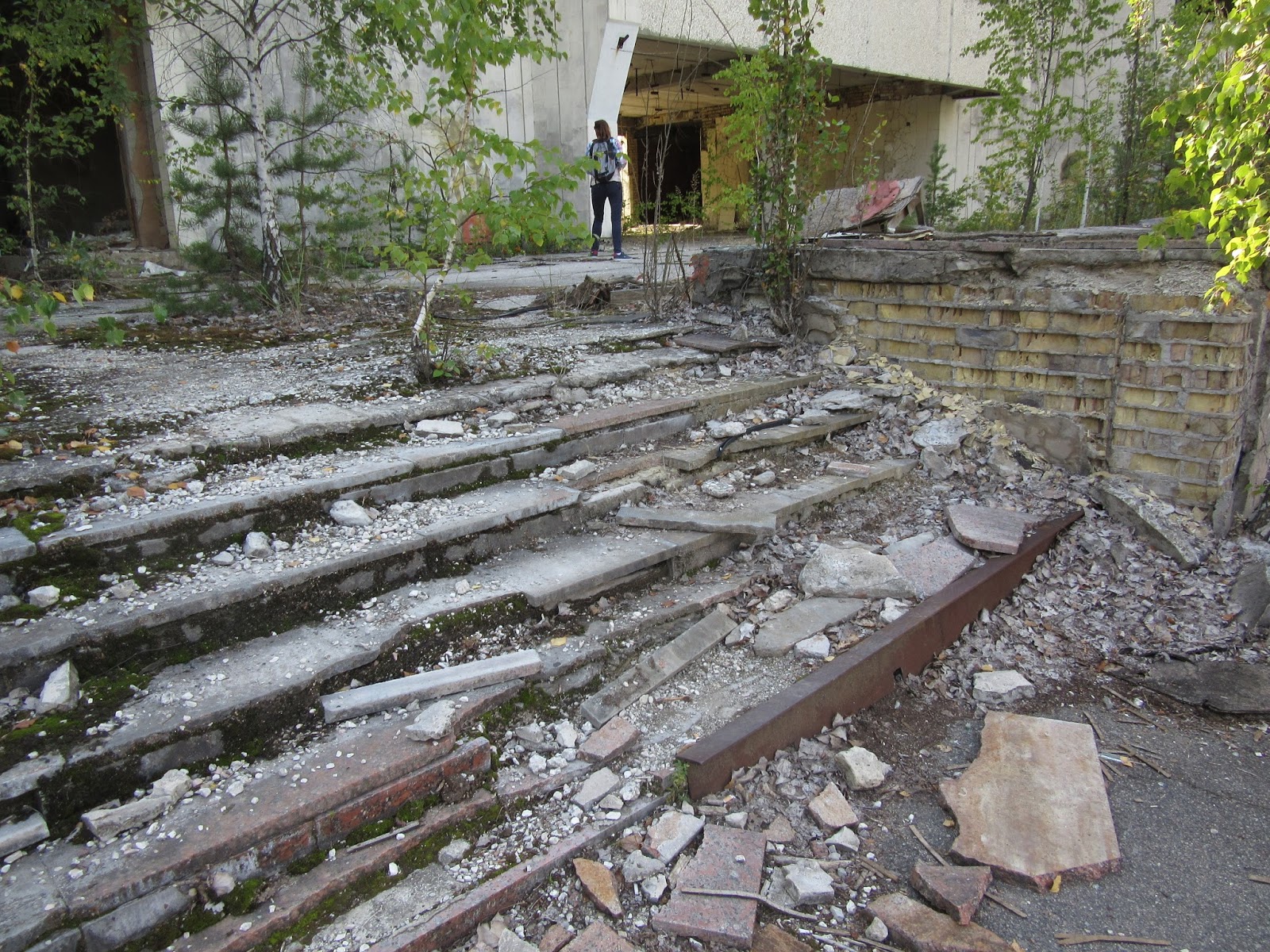
We next visited Priypat. Dasha told us we’d be walking
around the town for more than an hour looking at what remained of the ghost
town. The main street:

The Hotel:

One of the town’s grocery stores: So as not to lose money,
the Soviet Union collected all the food in the abandoned
grocery store and sold it elsewhere, Dasha told us. It’s hard for me to
comprehend that sort of callous disregard for the plight of its own citizens.

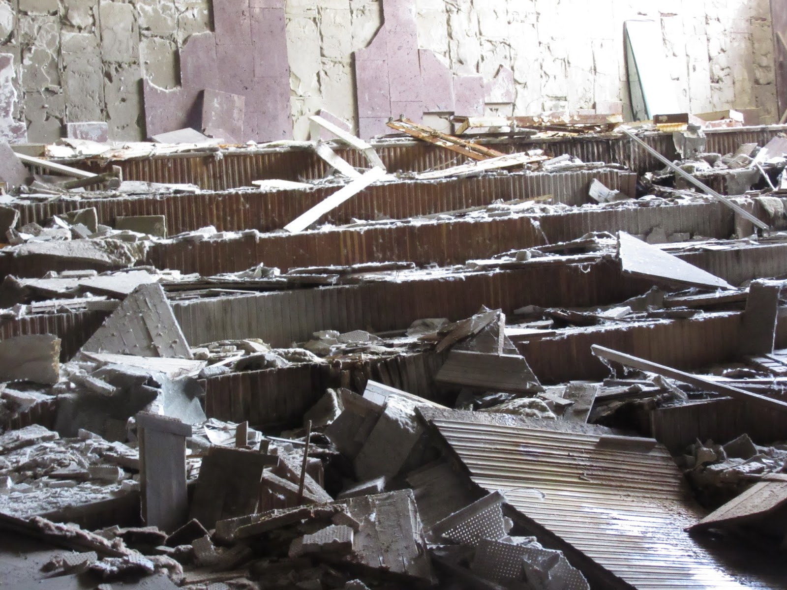
One of the local community centers:

Eerie hearing the crunch of glass each time we walked over it.
Walking in any of these buildings was rather unnerving, not just because of
what had happened so nearby but because of how treacherous most of the stairs,
hallways, etc we walked on or along. One false move and there was concern
whether the floor was still strong enough to support any of us.


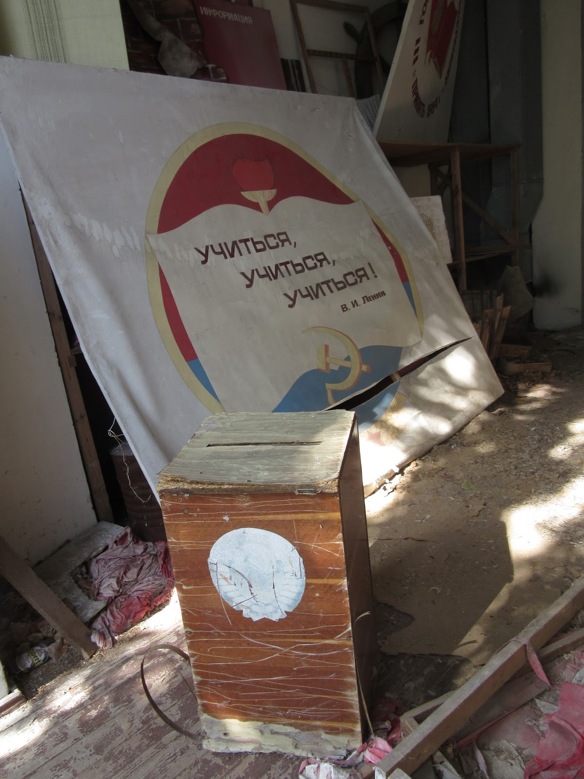
In an adjacent building, posters prepared for the upcoming May Day celebrations:


Near the posters was a voting box: you could vote yes or no, that was it.
The local amusement park: You may recall seeing photos of the ferris wheel before as it's one of those iconinc photos of 'Chornobyl.'


Dasha said the Soviets built ugly stuff but they sure built
it to last!


All that’s left of the soccer stadium or football as it's called everywhere but in North America:


The local pool: Judy: All I could think of while I was there
was how much I was missing your water aerobics classes at Lilley Gulch. Of course,
by now, sadly so many other people are too.


School #3: There are still high levels of radioactive soil
near the school because the soil couldn’t be removed from this area as the
building was too close to others. There were only two ways to deal with the contaminated soil:
cover it with asphalt and concrete or remove the soil. The latter method wasn’t
practical of course because you’re talking about such a mammoth geographical
area that was affected. Over a half million people took part in the cleanup.

More photos of the school:


English language textbook:

The science lab:

We walked on discarded books piled so thick, it was like
walking on a heavily padded carpet.

Richard and Claire: A lovely couple from England we met on the tour who shared our love for traveling. They had driven all the way from England so they had some exciting tales to tell of their adventures.

Photos of the local prison:


The fire station:


We walked down to the river port next. The sign says Café Priypat on River Priypat:

A vending machine, with one glass of water used by everyone, that dispensed sparkling water: you had a choice of plain or with syrup.

What a seemingly peaceful river.

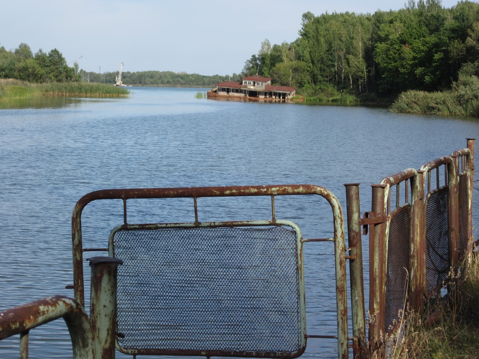
However, the Geiger counter registered the highest reading
of the day right by it.

Three seasons are represented on the mural in
the cafe. Summer is missing because it was destroyed. Remember the explosion
happened shortly before the coming of summer too.


Broken pieces of the mural lay on the ground:


The Geiger counter registered readings up to 7.2 as the bus
passed by the same Red Forest
We were tested for radiation levels when we left
the 10 km and 30 km exclusion zones. See the stop sign in English? Virtually everywhere we have traveled so far this trip, all stop signs are in English. I am still dumbfoundeded by that.

Here is the 10 km exclusion zone radiation checkpoint:


Below, the 30 km checkpoint which was five times more sensitive.
Luckily, none of the people on the bus registered when going through.

Just outside the checkpoint was this rotary dial phone. It was from May, 1962, the guard explained to us
tourists with great amusement!

It was haunting seeing a short film in the bus on the long
drive back to Kyiv of life in Priypat just the year before the explosion.
My feeling throughout the day was that everything looked so very
normal apart, of course, from the abandoned villages, etc. I think that must be
the insidiousness of the radiation because you can’t feel it, you can’t see it, you can’t hear it but, after an explosion, it IS just all around you.
As of 10/2/15 ,
there were 435 nuclear power plants operating in 40 countries.
This was my favorite post so far! What a completely unique experience-it must have felt so odd to be in the abandoned towns.
ReplyDeleteWow. What a sobering trip. Glad to hear neither of you registered for radiation at the checkpoints!
ReplyDeleteYou and us both, Adam! The scale of the disaster itself and the resulting cover up were indeed sobering but it also amazing to discover the self settlers who returned to Chernobyl to live out their last years.
ReplyDelete